Features PROTEGETEC
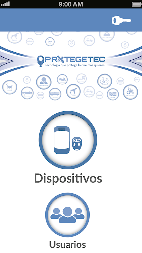
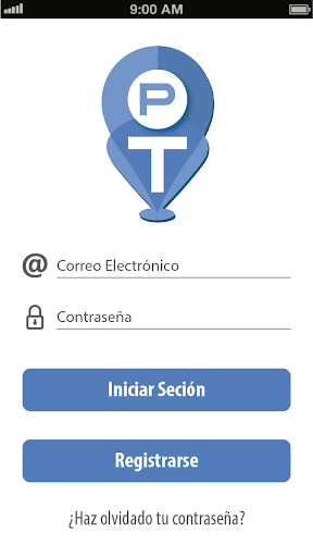
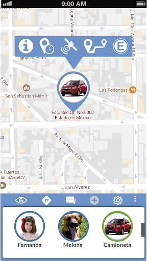
PROTEGETEC, is a tool used for administrative and operational management of geolocation, prevention and satellite tracking of vehicles, fleets, human resource management and livestock, through a friendly and intuitive interface with new features and sending alerts to Smartphone with a 24/7.Among the features offered by the application of PROTEGETEC are divided into three major categories: Administrative, Geolocation and Prevention.Functionalities administrative help us control our in implementing resources such as:- Information Administrator- General Device Information- Data Device- Map of devicesGeolocation functionality help us visualize present and past time our resources.- Route day- Historic Route 30 days- Route minutes- real-time geo one or more devices on the map- Share location of the device.- Charting arrival route to the device from the location of the SmartphonePrevention functionalities as its name indicates help us prevent contingencies resources through:- Virtual Perimeter fences or Geofence- Button parked- Engine Off-- Panic button- Call the device- Speed Alerts- Alerts Handling
Social Features
Connect and share with friends and the community.
Financial Tools
Manage your finances and track your expenses easily.
Food & Dining
Discover recipes and order food from your favorite restaurants.
See the PROTEGETEC in Action
Get the App Today
Available for Android 8.0 and above